Reducing Impacts on Elephants from the Pan-Borneo Highway
Project Overview
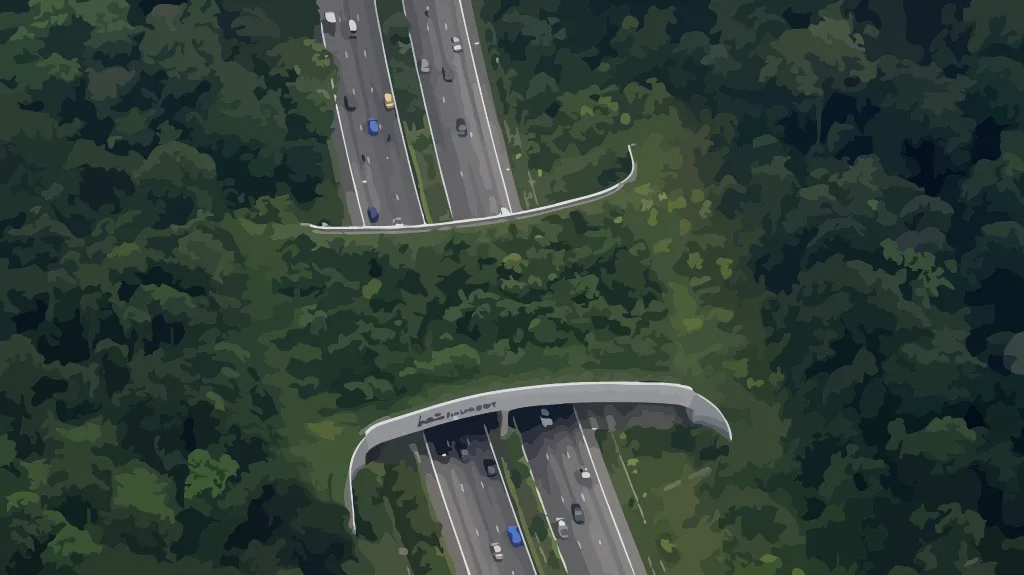
The Pan-Borneo Highway is Malaysia's largest infrastructure project, with several stretches in Sabah bisecting between 30 and 170 km of forest reserves and potentially having devastating consequences for Bornean elephant (Elephas maximus borneensis) residents in the Central Sabah Managed Elephant Range. This project uses satellite imaging, radio collaring, grid-based sign sampling, camera traps, and field observation to establish baseline data on how elephants currently use the areas that will be impacted by construction. The data feeds vulnerability analyses to assess how elephants in Tawai and Kalabakan Forest Reserves are likely to be affected, and informs the development of a predictive model to forecast elephant movements before, during, and after road construction. The project aims to identify critical risk areas and periods for elephant groups and individuals, define elephant-safe working practices during construction, and identify practical mitigation measures to facilitate elephant movements and reduce human-elephant conflict. Findings will be disseminated to policymakers, conservationists, and the scientific community as input for evidence-based decision-making in Asian elephant range states.
The project responds to the urgent need for proactive action to minimise and mitigate the threats posed by linear transport infrastructure development on Asian elephants. Field studies using satellite imaging, radio collaring, camera traps, and grid-based sign sampling will provide reliable baseline data on how Bornean elephants currently use the areas that the construction of the road will impact. Vulnerability analyses will assess how elephants are likely to be affected at different project stages.
A predictive model will forecast elephant movements using data collected before, during, and after road construction. Comparison of survey data on elephant distribution and habitat use with the projected extent of habitat degradation at different construction stages will identify critical risk areas and periods for affected elephant groups. The model will help the scientific community further its understanding of human-elephant conflict and inform practical mitigation measures.
The project brings together researchers from Cardiff University and Universiti Malaysia Sabah, working closely with the Sabah Wildlife Department and Sabah Forestry Department. Findings will be incorporated into the design of mitigation measures through dialogue with all responsible government agencies, and the project will train people in the area on how to respond to elephant encounters, contributing to public support for elephant conservation in Sabah.
Team


Funding

Partners